Information
RO Data Description
Data type: - ionPrf / - igaPrf
ionPrf is one of the data products from FORMOSAT-7/COSMIC-2 occultation observation, which includes the ionospheric electron density profiles, the calibrated TEC, geographic longitude / latitude / altitude at perigees, etc.
igaPrf is another data products derived from ionPrf, which includes corrected electron density profiles and some related observables.
The major difference between ionPrf and igaPrf is: the former is derived from the standard Abel inversion; the latter is derived from the aided-Abel inversion.
ionPrf Profile Data
- MSL_alt: Mean sea level altitude of perigee point in km
- GEO_lon:Geographic longitude of perigee point in °E
- GEO_lat:Geographical latitude of perigee point in °N
- TEC_cal:Calibrated occultation TEC below LEO orbit in TECU
- ELEC_dens:Electron density in el/cm3
igaPrf Profile Data
- MSL_alt:Mean sea level altitude of perigee point in km
- GEO_lon:Geographic longitude of perigee point in °E
- GEO_lat:Geographical latitude of perigee point in °N
- TEC_cal:Calibrated occultation TEC below LEO orbit in TECU
- ELEC_dens:Aided electron density in el/cm3
- ELEC_dens_orig:Original electron density in el/cm3 (same as ELEC_dens in ionPrf)
- ELEC_dens_bg:Background electron density in el/cm3
ionPrf Data Processing
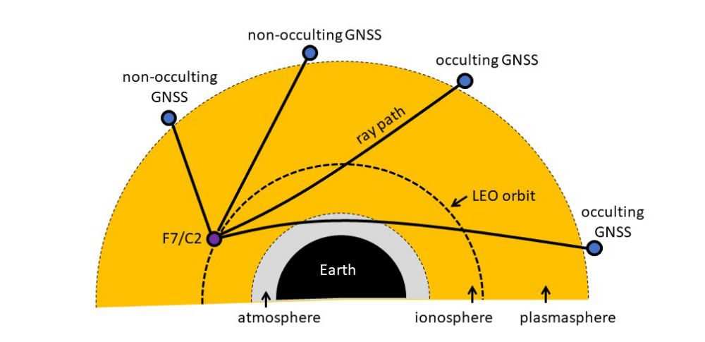
Since FORMOSAT-7/COSMIC-2 provides dual-frequency GNSS occultation and non-occultation observables, the ionospheric electron density profile can be retrieved from two data processings: the excess phase data processing and ionosphere inversion processing.
The former data processing estimates the ionospheric excess phase by the following procedures:
- Read in 1-second sampled dual-frequency GNSS phase observables
- Derive the linear combinataion of the excess phase by linear differencing
- Identify occultation flag (rising/setting) or indicate it if it is an non-occultation event based on the orbital information of GNSS and LEO satellites
The latter processing retrieves the ionospheric electron density profile by the following procedures:
- Read in electron density profiles in ionPrf
- Reconstruct 3-dimensional global electron density field as the background field based on 45-day worth of the profiles
- Convert the calibrated TEC into the corrected (aided) electron density profiles based on the aided-Abel inversion (cf. Chou et al., 2019)
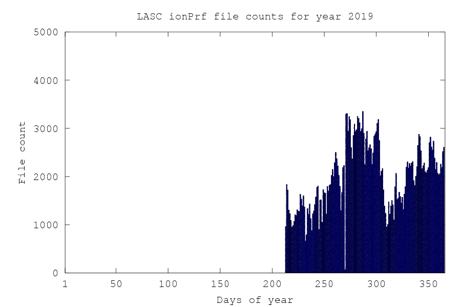
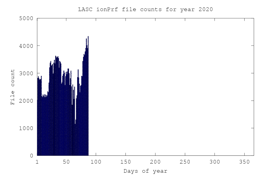
These figure shows the number of daily FORMOSAT-7/COSMIC-2 ionospheric profiles.
Reference:
Chou, M. Y., C. C. H. Lin, H.-F. Tsai, and C.-Y. Lin (2017), Ionospheric electron density inversion for Global Navigation Satellite Systems radio occultation using aided Abel inversions, J. Geophys. Res. Space Physics, 122, doi:10.1002/2016JA023027.